

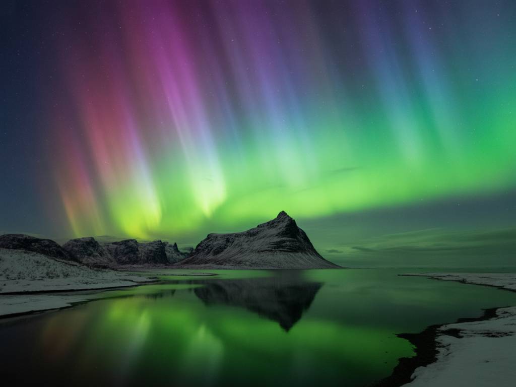
Why an aurora forecast alone is not enough
If you only look at the KP index before a northern lights trip, you’re flying half blind.
The KP index tells you how strong the geomagnetic activity could be. But it doesn’t tell you if you’ll actually see anything from the place where you’re standing, under the sky you’ll get tonight.
To turn “solar activity” into “real chances of seeing auroras”, you need two forecasts to work together:
- an aurora forecast (KP, Bz, oval position, substorms)
- a local weather forecast (cloud cover, wind, temperature, showers, fog)
When those two agree, your night becomes simple: you know where to drive, when to leave the hotel, how long to wait, and when it’s time to go back to bed.
In this article, I’ll walk you through how I actually combine these two blocks of information on the ground, from my evenings in Tromsø, Abisko, Rovaniemi and on the Icelandic ring road. The goal is that you can do the same, without spending two hours every night decoding graphs.
Aurora forecasts: what they really tell you (and what they don’t)
A typical aurora forecast gives you three key ideas:
- How strong the auroral activity might be (often via the KP index)
- How far south the auroral oval could extend
- When the peak activity is expected
Here’s what each part means in practical terms.
1. KP index: your “range” indicator
The KP index runs from 0 to 9. For most popular northern lights destinations:
- KP 1–2: Good for high latitude locations (Tromsø, Alta, Abisko, Finnish Lapland, northern Iceland). You usually need a dark sky and to look north.
- KP 3–4: The oval widens. Auroras often visible higher in the sky or even overhead in the same locations. In central Lapland or southern Iceland, your chances increase a lot.
- KP 5 and above: Strong geomagnetic storm. Auroras can be visible much further south (Scotland, Baltic states, sometimes northern Germany or US states like Montana, Minnesota).
But KP alone is global. It can be KP 5 and perfectly clear in theory, and still be a useless night for you if your local sky is completely blocked by clouds.
2. Auroral oval position: your “where to look” indicator
Most maps show a green band around the magnetic pole: the auroral oval. For trip planning, I use it this way:
- If your location is under the oval, you can expect the aurora somewhere between north and overhead if activity is not too weak.
- If you’re south of the oval, you’ll likely see auroras low on the northern horizon, and you’ll need higher KP for them to climb higher in the sky.
This helps decide if it’s worth driving a bit north (for example, from Narvik to Skibotn, or from Rovaniemi towards Sodankylä) when the KP is low.
3. Short bursts vs quiet arcs: timing matters
Even when the KP looks “okay”, auroras are not a continuous neon sign. They often follow this pattern during a good night:
- A long quiet phase: faint arc in the north, maybe barely visible to the naked eye.
- A substorm lasting 10–30 minutes: sudden brightening, fast movement, curtains, crowns overhead.
- A new quiet phase, then sometimes another substorm.
Most aurora models try to estimate when those active periods are more likely, but they’re never exact. This is where local weather forecasting becomes your second filter: you need clear (or clear enough) sky during those windows, not just sometime during the night “in general”.
Local weather: the “yes or no” for your sky
Once you know that the aurora could be active, the local weather forecast decides if you will see it.
For aurora chasing, I mostly care about four weather elements:
- cloud cover (low, middle, high)
- wind direction and speed
- temperature and humidity (fog, ice fog in valleys)
- precipitation (showers, snow bands)
Cloud cover: your main filter
A solid low cloud deck at 800–1500 m altitude is usually a total blocker. High thin clouds can be more forgiving: the aurora can shine through them if it’s strong.
On maps, I look for:
- Breaks in the cloud cover: narrow clear slots can be enough if they align with the northern horizon.
- Cloud gradients: places where the cloud cover drops from 100% to 20% over 30–50 km. That’s often where I drive.
- Different layers: clear at low level but covered with high clouds can still be workable. The reverse is usually bad news.
Wind: your natural cloud-clearing system
Wind tells you if clouds will move away or trap you. For example:
- On the Norwegian coast, northwest winds often bring showers and low clouds from the sea, while offshore winds (from the continent) can clear the coast.
- In inland valleys, calm winds and high humidity can create fog and ice fog that stick all night. Moving 200–300 m higher in altitude can put you above it.
So when you see a 100% cloud cover forecast, always check if the wind will push that layer somewhere else in a few hours. A cloudy 20:00 forecast might turn into clear skies at 23:00 if a drier air mass moves in.
Temperature and humidity: the valley trap
On very cold, calm nights, low-lying areas (river valleys, lakes) can fill with fog. It looks perfect on the general forecast, but on the ground you’re standing under a grey lid.
In Lapland and northern Sweden, I’ve often had to do this:
- Start from a hotel in a foggy village at -20°C
- Drive 15–20 minutes up a gentle hill or pass (just 150–250 m higher)
- Suddenly emerge above the fog into perfectly clear skies and bright auroras
Always note the elevation of your base town and compare it to surrounding viewpoints or passes on the map.
Precipitation: timing your windows
Snow showers and rain bands can kill 30–60 minutes of a good aurora display, but they often move quickly. Short, intense showers followed by clear slots are common on coasts like Iceland or northern Norway.
This is where the hourly precipitation forecast is useful. If a band crosses between 21:00 and 22:00, plan your drive or coffee break during that time and aim to be in your best spot before and after it, when the sky opens again.
Combining both: a simple decision method
Let’s put this together into something you can actually use to decide “go” or “no go” each night.
Step 1 – Check if the aurora is realistically possible from your latitude
- If KP is forecast around 0–1 and you are in southern Finland, Scotland or central Sweden: your chances are very low. Use the evening for something else.
- If KP is forecast around 2–3 and you’re in Tromsø, Abisko, northern Finland or northern Iceland: you are in the game, especially under clear skies.
- If KP is forecast around 4–5+: even in more southern locations, you have a shot if the sky cooperates. In the auroral zone, this is where big shows are common.
Step 2 – Check cloud cover and find your nearest “window”
- Look at hourly cloud maps from evening to early morning.
- Mark the hours with less than 50% low cloud cover over your area or within about 100 km driving distance.
- If there is no clear slot at all within 150 km all night, save your energy. Even during geomagnetic storms, a complete low overcast is ruthless.
Step 3 – Match your clear slot with the likely aurora timing
Aurora activity is often higher:
- near magnetic midnight (not always the same as clock midnight, but usually around 22:00–01:00 local time in the auroral zone)
- during periods where models predict a short increase in activity or when Bz turns strongly south (if you follow real-time data)
If your best clear window is 21:00–23:00, but the geomagnetic models suggest a peak after midnight, your plan might be:
- Go out early and set up if the sky is clear enough.
- Stay flexible: if the sky starts to close again, consider changing spot or accepting that you may miss the theoretical peak in exchange for actual clear sky.
Step 4 – Choose direction and altitude, not just distance
- Prioritise driving towards clearer sky, even if it’s only 30–40 km away.
- If valley fog is present or likely, aim for a slightly higher road or pass, not necessarily far away.
- On the coast, move slightly inland or behind small mountains if showers are coming from the sea.
Two real-world style scenarios
Scenario 1: Tromsø, mixed clouds, KP 3 forecast
Let’s say you are in Tromsø in February. The aurora forecast for the evening shows:
- KP 2–3, potential increase around 23:00
- Auroral oval comfortably over northern Norway
Local weather shows:
- Broken low clouds over Tromsø (60–80%) in the evening
- Clearing trend after 22:00 inland, especially around Skibotn and the Finnish border (20–40% clouds)
- Light snow showers moving along the coast
This is how I’d plan it:
- Have an early dinner in town, prepare thermos and layers.
- Aim to leave Tromsø around 20:30–21:00 and drive towards Skibotn (about 1.5 hours).
- Check the sky regularly while driving. If the clouds start to break earlier in a valley, I may stop there instead of going all the way.
- Arrive in the clearer zone by 22:00, park at one of the known lay-bys with a north-facing view.
- Stay at least until 00:30, with the main expectation that the best show could happen between 22:30 and 23:30.
In this scenario, the local forecast doesn’t change the fact that KP 3 is enough in Tromsø’s latitude. It simply tells you where your KP 3 will actually be visible: inland, not over the city.
Scenario 2: Reykjavik, unstable weather, KP 5 forecast
Now you’re in Reykjavik, and the forecast is:
- KP 4–5, potentially high activity all evening
- Strong auroral oval covering all of Iceland
Weather forecast:
- Heavy showers with full cloud cover on the southwest coast from 18:00 to 22:00
- Clearer skies predicted in the south and southeast after 22:00 (around Selfoss, Vik)
- Gusty winds from the southwest, pushing cloud bands inland
Plan:
- Don’t waste time checking the sky every 5 minutes in Reykjavik early in the evening.
- Monitor the radar/precipitation map. Once you see a back edge of the main rain band around 21:00, drive out of the city behind it, towards the clearer zone.
- Even if the forecast says “partly cloudy”, remember that with KP 5, gaps in the clouds are often enough.
- Stop at 1–2 preselected wide lay-bys or small roads off Route 1 with a clear northern horizon.
Here, the aurora forecast is excellent but meaningless if you stay under the coastal cloud band. The local weather forecast converts a “big storm” headline into a real, practical route.
Managing your expectations night by night
One of the biggest sources of stress I see in travellers is the idea that every night must be “the big night”. It doesn’t work like that.
This combined forecast approach helps you categorize your nights realistically:
- High potential nights: KP 3+ and at least one 2–3 hour clear slot within a 100 km radius. These are your “commit fully” nights: long drive if needed, late return, strong hope for photos and visual show.
- Medium potential nights: KP 2–3 with partial clouds, or good KP but only short clear breaks. These are your “flexible” nights: stay close to town, choose easy-access spots, and be ready to move quickly if the sky opens.
- Low potential nights: KP very low and total overcast or continuous snow. These are your “rest and recharge” nights: enjoy the sauna, review your photos, check gear, and get ready for the next window.
Labeling the night like this in your head before dinner already removes a lot of pressure. You’re not “failing” if you stay in on a low potential night; you’re just aligning your effort with the real data.
Quick checklist for your own trip
Before each night, run through this short checklist:
- Where is the auroral oval relative to my position?
- What KP is forecast, and is that normally enough for my latitude?
- At what hours do I see cloud cover dropping below 50% within 100 km?
- Is fog or low valley cloud likely around my town?
- From the wind direction, are clouds moving in or out of my area tonight?
- Do I have at least two realistic viewing spots with parking, clear north view and a safe road, in different directions?
- Based on all this, is tonight high, medium or low potential?
Answering these seven points doesn’t take more than 10–15 minutes once you’re used to it, and it turns a confusing mix of graphs and maps into a clear plan: stay, move, or sleep.
When the aurora forecast and the local weather forecast both give you a green light, that’s when you want to be ready, warm, and already standing under the darkest piece of sky you can reach.